
Site classification
Site information explained
The Site information tab records what you see on the lot: size, slope, trees and drainage. An engineer uses it to set the class.
Open a project and choose the Site information tab. Press Add site information. The form says: "These details feed the site classification."
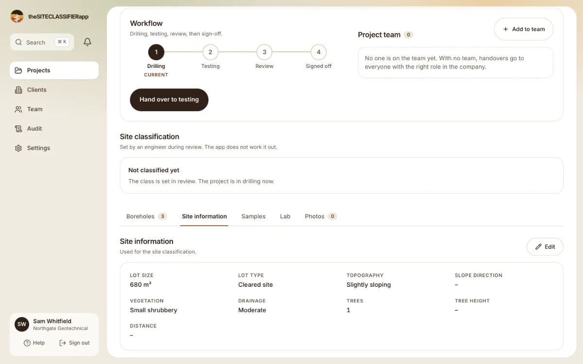
The tab says: "Record the lot, slope, trees and drainage so the engineer can classify the site." You record what you see. The engineer decides the class. See Who sets the site class.
The fields
Lot size (m²) and Lot type
Lot size is the area of the lot. It is optional. Lot type is Cleared site or Existing dwelling. This matters because the history of the lot changes how the ground has moved.
Topography
Topography is the shape of the land: Flat, Slightly sloping, or Required slope stability. If you choose a slope, the form shows Slope direction. You may choose more than one: front to back, back to front, left to right, right to left.
Vegetation
Choose Cleared site, Small shrubbery, Some trees or Heavily treed. Roots take water out of clay. That makes it shrink.
Drainage
Poor, Moderate or Good. Water that stays near the footings makes clay swell.
Trees
Number of trees is required. If there are trees, the form also asks for:
- Tree height: Small (1-2 m), Medium (2-5 m) or Large (more than 5 m).
- Distance to the footing: 1-5 m, 5-10 m, 10-15 m, 15-20 m or more than 20 m.
Was this helpful?
Still stuck?
Tell us what happened. We will see which article you were reading.